
Season:
Summer
Difficulty:
Hard
Region:
Samegrelo
Duration:
5+ Days
Type:
Hiking / Trekking
Season:
Summer
Difficulty:
Hard
Region:
Samegrelo
Duration:
5+ Days
Type:
Hiking / Trekking
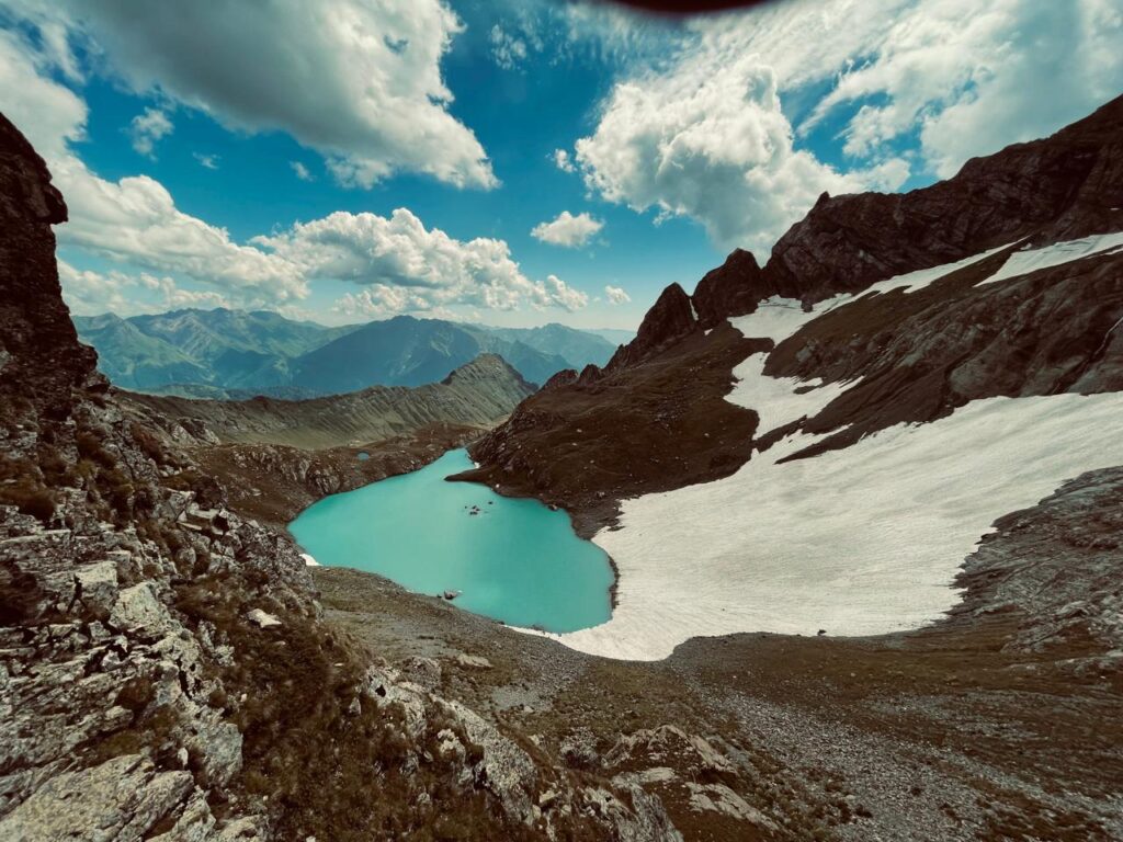
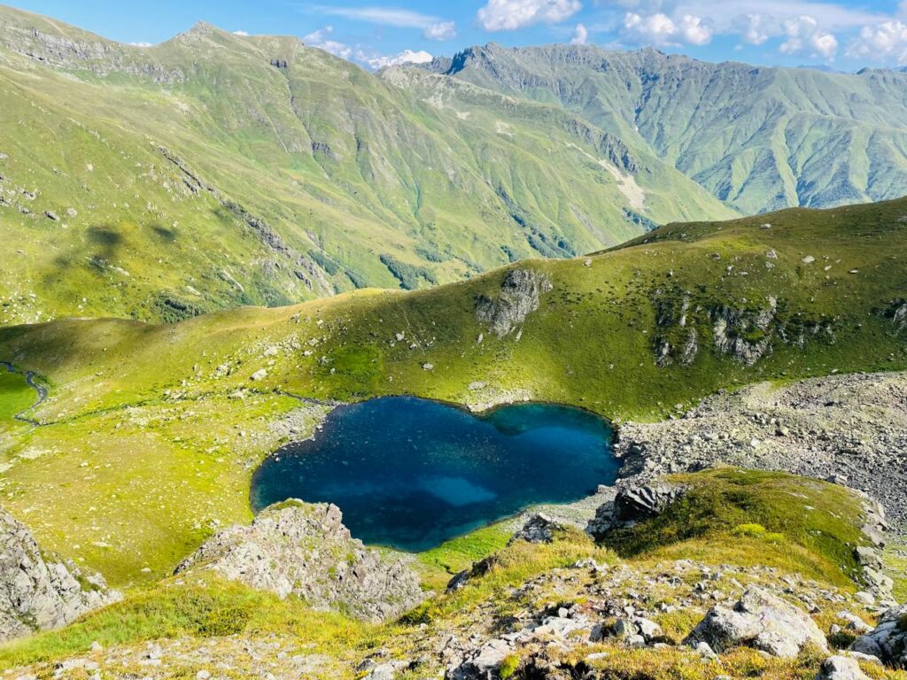
The Tobavarchkhili (Literally Silver Lake) is a dramatic and remote system of 5 lakes hidden deep within the Egrisi Range on the border of Samegrelo and Upper Svaneti. This multi-day trek combines high mountain passes, turquoise alpine lakes, deep gorges, and vast open basins shaped by glacial activity. It is a physically demanding route intended for experienced hikers seeking true wilderness.
Day-by-Day Itinerary (click to expand):
Day 1 : Tbilisi / Kutaisi → Mukhuri Village
Driving time:
From Tbilisi: ~6–7 hours
From Kutaisi: ~3.5–4.5 hours
We depart from Tbilisi or Kutaisi and drive west toward Samegrelo, following mountain roads into the foothills of the Egrisi Range. By late afternoon, we arrive in Mukhuri, the last permanently inhabited village on this route and the logistical gateway to the mountain range. Accommodation is in a local guesthouse. The evening is reserved for a group briefing, equipment check, route overview, and early dinner. Overnight in Mukhuri allows for proper rest before entering remote, uninhabited terrain the following morning.
Day 2 : Mukhuri → Natipuru Shelter → Alpine Meadows Camp
Hiking Distance: ~11 km
Elevation Gain: ~ 800 m
In the morning, we transfer by 4×4 vehicle along a rough mountain road to Natipuru Shelter, where the hike begins. From here, we ascend gradually through dense forest that slowly gives way to open alpine meadows. The trail follows old shepherd paths, crossing streams and wide grass-covered slopes with increasing views toward the Egrisi ridge line. By afternoon, we reach a high alpine basin used seasonally by shepherds. Camp is set in open terrain with wide panoramas and complete isolation.
Day 3 : Alpine Meadows → Okhoje Pass → Okhoje (Lesser Toba) Lake
Hiking Distance: ~4 km
Elevation Gain: ~600 m
Today begins with a steady ascent toward Okhoje Pass (approx. 2,750 m). The climb is continuous but non-technical, offering expanding views over Samegrelo on one side and the Tobavarchkhili massif on the other. After crossing the pass, the terrain opens dramatically, and we descend into a glacial basin holding Okhoje Lake, often referred to as Lesser Tobavarchkhili. The lake’s turquoise color and surrounding rock walls create one of the most breathtaking campsites of the trek. Camp is set near the lake.
Day 4: Okhoje Lake → Eastern Pass → Tobavarchkhili (Greater Silver Lake)
Hiking Distance: ~6 km
Elevation Gain: ~400 m
A shorter but visually intense day. We climb to a higher eastern pass (~2,850-2,900 m), where the first full view of Tobavarchkhili (Greater Silver Lake) appears below – a vast, steel-blue lake surrounded by steep slopes. The descent leads directly to the lake shore. Camp is set beside the water, with towering cliffs and constant movement of clouds and light. This is the heart of the route and one of the wildest alpine settings in Georgia.
Day 5: Tobavarchkhili Exploration Day
Hiking Distance: 4–8 km (optional)
Elevation Gain/Loss: variable
This is a flexible day without full packs – we leave our camp set up at the Greater Silver Lake. Depending on weather and group condition, we explore the surrounding area: nearby smaller lakes and viewpoints overlooking the Colchis Lowland, which extends all the way to the Black Sea. Those who prefer rest can remain at camp, enjoy the silence, and take in the changing moods of the lake. Weather often shifts rapidly here, adding to the atmosphere and sense of remoteness. A quick cold plunge in the lake is optional, but refreshing.
Day 6: Tobavarchkhili → Magana Valley → Jolora River Camp
Hiking Distance: ~13 km
Elevation Loss: ~900 m
After picking up every crumb we may have dropped, we leave Tobavarchkhili and begin a long descent into the Magana Valley, following the river system that drains the lake. The trail passes dramatic waterfalls, narrow gorges, and open slopes used by shepherds during summer months. As elevation drops, vegetation becomes denser. Camp is set near the Jolora River, in a sheltered area with access to water and flat ground.
Day 7: Jolora Valley → Forest Zone → Skuri Area
Hiking Distance: ~10 km
Elevation Loss: ~700 m
The final hiking day follows forest trails and river crossings as we exit the high mountains. The route gradually transitions from alpine wilderness back into inhabited territory. By afternoon, we reach the Skuri area, where transport meets the group. Transfer to Kutaisi follows, with overnight either in Kutaisi or continuation to Tbilisi depending on logistics.
This is the kind of place that doesn’t try to impress you. It exists, vast and indifferent, and lets you measure yourself against it. Days blur into ridgelines, cold water, aching legs, and long silences broken only by wind or human communication. You leave physically tired, but quietly changed – thoughts feel clearer and you feel the rare satisfaction of having gone somewhere that few ever will.



Key Stats
Trail Type: A to B
Total Distance: 50 km
Starting Elevation: 1200 m
Max Elevation: 2907 m
Total Ascent: 4572 m